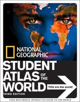
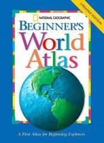
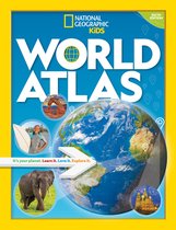
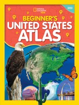
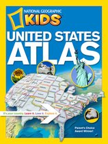
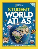
National Geographic Kids World Atlas (Atlas ) It's Your Planet. Learn It, Love It, Explorer It
Afbeeldingen
Sla de afbeeldingen overArtikel vergelijken
Auteur:
National Geographic
- Engels
- Paperback
- 9781426306877
- 15 augustus 2010
- 208 pagina's
National Geographic
National Geographic ken je misschien van tv en de tijdschriften maar ze doen nog meer. Het merk is in samenwerking met Bresser (een merk dat al meer dan vijftig jaar verrekijkers en telescopen ontwikkelt) zijn eigen producten op de markt gaan brengen. Vanaf nu kun je zelf op ontdekkingstocht gaan en onderzoek uitvoeren met de producten van National Geographic. Ga je ’s nachts op pad? Ga dan voor een nightvision verrekijker van National Geographic, zo zie je altijd wat er ’s nachts gebeurt. Wil je exact weten wat voor weer het is, voor je op pad gaat? Bekijk dan eens de weerstations van dit merk. Installeer buiten de sensoren en je kunt binnen precies aflezen wat voor weer het is. Ga voor een verrekijker als je op wandeltocht gaat, of een telescoop als je de sterren eens goed wilt bekijken. Ben jij klaar om te ontdekken?
Samenvatting
In the new, reduced trim size edition of National Geographic's award-winning World Atlas for Young Explorers, we've punched up the content with the very latest maps, data, and essays about the world and all that is in it. More than 200 colour images transport kids to intriguing places, and 115 pages of full-size National Geographic maps help them locate countries, cities, regions, and more. Created by the most trusted name in cartography, these colourful maps have been custom designed for middle-grade students. Boundaries, place-names, and data reflect the most current information available, and every map appears in the context of surrounding areas to ensure that a full picture of the world develops. Same-size physical and political maps make for easy comparisons and help youngsters understand how physical features influence patterns of human settlement and economic activity. Locator globes and color-coding make it easy for kids to keep track of where they are and quickly navigate from one region to another. Stunning images from space draw visual links between real-world scenes and cartography. Plus, an interactive Web feature links kids to the Society's vast archive of maps, articles, photos, videos, music, languages, crafts, quizzes, and more. With a dynamic reference like this, homework has never been so fascinating.
Productspecificaties
Wij vonden geen specificaties voor jouw zoekopdracht '{SEARCH}'.
Inhoud
- Taal
- en
- Bindwijze
- Paperback
- Oorspronkelijke releasedatum
- 15 augustus 2010
- Aantal pagina's
- 208
- Illustraties
- Nee
Betrokkenen
- Hoofdauteur
- National Geographic
- Hoofduitgeverij
- National Geographic Kids
Overige kenmerken
- Editie
- 3
- Extra groot lettertype
- Nee
- Studieboek
- Ja
- Verpakking breedte
- 233 mm
- Verpakking hoogte
- 11 mm
- Verpakking lengte
- 301 mm
- Verpakkingsgewicht
- 810 g
EAN
- EAN
- 9781426306877
Je vindt dit artikel in
- Categorieën
- Taal
- Engels
- Studieboek of algemeen
- Studieboeken
- Boek, ebook of luisterboek?
- Boek
- Beschikbaarheid
- Leverbaar
Kies gewenste uitvoering
Kies je bindwijze
(3)
Prijsinformatie en bestellen
De prijs van dit product is 24 euro en 57 cent. Dit is een tweedehands product.Alleen tweedehands
Goed
Ref8666
Ref8666
Uiterlijk 5 juni in huis
Verkoop door
BAY EXPRESS
- Bestellen en betalen via bol
- Prijs inclusief verzendkosten, verstuurd door BAY EXPRESS
- 30 dagen bedenktijd en gratis retourneren
Shop dit artikel
Rapporteer dit artikel
Je wilt melding doen van illegale inhoud over dit artikel:
- Ik wil melding doen als klant
- Ik wil melding doen als autoriteit of trusted flagger
- Ik wil melding doen als partner
- Ik wil melding doen als merkhouder
Geen klant, autoriteit, trusted flagger, merkhouder of partner? Gebruik dan onderstaande link om melding te doen.

