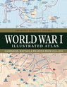
World War I Illustrated Atlas Campaigns and Battles from 1914 to 1918
Afbeeldingen
Sla de afbeeldingen overArtikel vergelijken
- Engels
- Hardcover
- 9781838863548
- 14 oktober 2023
- 192 pagina's
Samenvatting
WWI was a complex conflict: an air war, a land war fought in the Balkans, NW Europe, Italy, Africa, Turkey and the Middle East, and a naval war in the North Sea, South Atlantic, South Pacific and Indian Oceans. Including over 180 detailed maps, World War I Illustrated Atlas is an invaluable reference guide to this global war.
World War I might conjure up images of the trenches of the Western Front where the fighting raged for nearly four and half years, but this was only part of what was truly a world war. It was a complex conflict fought in a number of theatres: an air war, a land war fought in the Balkans, Italy, Africa, Turkey and the Middle East, and also a naval war fought in the North Sea, South Atlantic, South Pacific and Indian Oceans. The ‘Great War’ introduced killing on an unprecedented scale and resulted in the loss of millions of lives.
World War I Illustrated Atlas is a comprehensive visual guide to this complex conflict. In fine detail, it plots the exact course of the land, sea and air campaigns, enabling the reader to trace the ebb and flow of the fortunes of all sides. With more than 180 full-colour maps, every theatre of war is covered – from the Western Front to Penang, from Gallipoli to Galicia, from Dogger Bank to Dalmatia, from Romania to Rhodesia and from the Falklands to Togo and the Sinai desert.
All the maps have been specially commissioned from an expert cartographer. Each map is designed to highlight a particular aspect of the war – thus maps vary in shape and size, with some giving a global perspective while others depict the exact movement of armed forces on land, sea or in the air. Battles such as Jutland, the Somme, Cambrai and the Gallipoli campaign are shown in great detail. All maps are accompanied by an explanatory key.
With expert, accessible text and accompanying archival photographs, this complete atlas provides an invaluable work of reference for both the general reader and the serious student of World War I.
Productspecificaties
Inhoud
- Taal
- en
- Bindwijze
- Hardcover
- Oorspronkelijke releasedatum
- 14 oktober 2023
- Aantal pagina's
- 192
Betrokkenen
- Hoofdauteur
- Michael S Neiberg
- Hoofduitgeverij
- Amber Books
Overige kenmerken
- Editie
- 1
- Product breedte
- 208 mm
- Product hoogte
- 20 mm
- Product lengte
- 270 mm
- Studieboek
- Ja
- Verpakking breedte
- 208 mm
- Verpakking hoogte
- 20 mm
- Verpakking lengte
- 270 mm
- Verpakkingsgewicht
- 950 g
EAN
- EAN
- 9781838863548
Je vindt dit artikel in
- Categorieën
- Taal
- Engels
- Boek, ebook of luisterboek?
- Boek
- Beschikbaarheid
- Leverbaar
- Onderwerp
- Historische geografie
Kies gewenste uitvoering
Prijsinformatie en bestellen
De prijs van dit product is 26 euro en 99 cent.- Prijs inclusief verzendkosten, verstuurd door bol
- Ophalen bij een bol afhaalpunt mogelijk
- 30 dagen bedenktijd en gratis retourneren
- Dag en nacht klantenservice
- Vandaag nog in huis (bestel ma-vr voor 12:00, bezorging tussen 17:00 en 22:00)
- Doordeweeks ook ’s avonds in huis
- Ook zondag in huis (bestel voor za 23:59)
Anderen bekeken ook


Vaak samen gekocht
Rapporteer dit artikel
Je wilt melding doen van illegale inhoud over dit artikel:
- Ik wil melding doen als klant
- Ik wil melding doen als autoriteit of trusted flagger
- Ik wil melding doen als partner
- Ik wil melding doen als merkhouder
Geen klant, autoriteit, trusted flagger, merkhouder of partner? Gebruik dan onderstaande link om melding te doen.