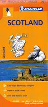
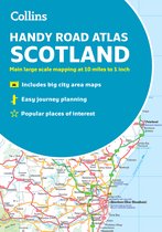
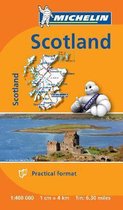
Philip's Road Atlases- Philip's Navigator Scotland
Afbeeldingen
Sla de afbeeldingen overArtikel vergelijken
Auteur:
Philip's Maps
- Engels
- Spiraalgebonden
- 9781849075459
- 06 mei 2021
- 144 pagina's
Samenvatting
Philip's Navigator Scotland is the UK's best-selling atlas of Scotland. The Navigator brand is famous for the UK's clearest mapping and superb extra detail - essential for the motorist, whether for business or pleasure - and all with a fully updated section on the best Scotland has to offer. 'A map that beats all others.' - The Daily Telegraph 'Scale, accuracy and clarity are without parallel.' - Driving Magazine 'No.1 in the UK for clear maps.' - Independent research survey - Exceptional clarity at a scale of 1.5 miles to 1 inch = 1:100,000 (3 miles to 1 inch = 1:200,000 for Northern Scotland) - No other road atlas of Scotland can provide this level of detail and touring information - Invaluable 'Best Places to Visit' section, including heritage spots, spectacular sights and the best walks, including the Southern Upland, West Highland, Great Glen and Speyside Ways - Key town-centre maps fully indexed for easy navigation - Exceptional road detail, from motorways to country lanes, with every junction, roundabout and slip-road shown - Packed with hundreds of individually named farms, houses and hamlets, alongside all the key heritage and cultural sites - Hard-wearing and practical A4 format with spiral binding Navigator Scotland offers so much more than a mere road map: hundreds of individually named farms, houses and hamlets, airports, airfields, stations, ferries, canals, harbours, tourist information centres, and a wide range of places of interest ranging from castles to chapels. Every element is clearly indexed for easy use and includes indexed town plans of all the major regional centres. Added to all that is a guide to Scotland's many leisure facilities and listings of a wide variety of activities from abseiling to yachting. The atlas is perfect for touring with its large scale and wealth of travel information. The exceptional detail also makes the atlas ideal for local business use.
Productspecificaties
Wij vonden geen specificaties voor jouw zoekopdracht '{SEARCH}'.
Inhoud
- Taal
- en
- Bindwijze
- Spiraalgebonden
- Oorspronkelijke releasedatum
- 06 mei 2021
- Aantal pagina's
- 144
Betrokkenen
- Hoofdauteur
- Philip's Maps
- Hoofduitgeverij
- Philip's
Overige kenmerken
- Product breedte
- 220 mm
- Product hoogte
- 10 mm
- Product lengte
- 294 mm
- Studieboek
- Nee
- Verpakking breedte
- 222 mm
- Verpakking hoogte
- 18 mm
- Verpakking lengte
- 303 mm
- Verpakkingsgewicht
- 414 g
EAN
- EAN
- 9781849075459
Je vindt dit artikel in
- Categorieën
- Land
- Schotland
- Regio
- Verenigd Koninkrijk, West-Europa
- Taal
- Engels
- Beschikbaarheid
- Leverbaar
Kies gewenste uitvoering
Bindwijze
: Spiraalgebonden
Prijsinformatie en bestellen
De prijs van dit product is 10 euro en 04 cent.
Verkoop door bol
- Gratis verzending door bol vanaf 20 euro
- Ophalen bij een bol afhaalpunt mogelijk
- 30 dagen bedenktijd en gratis retourneren
- Dag en nacht klantenservice
Bezorgopties
- Vandaag nog in huis (bestel ma-vr voor 12:00, bezorging tussen 17:00 en 22:00)
- Doordeweeks ook ’s avonds in huis
- Ook zondag in huis (bestel voor za 23:59)
Anderen bekeken ook

Vaak samen gekocht
Rapporteer dit artikel
Je wilt melding doen van illegale inhoud over dit artikel:
- Ik wil melding doen als klant
- Ik wil melding doen als autoriteit of trusted flagger
- Ik wil melding doen als partner
- Ik wil melding doen als merkhouder
Geen klant, autoriteit, trusted flagger, merkhouder of partner? Gebruik dan onderstaande link om melding te doen.